| |
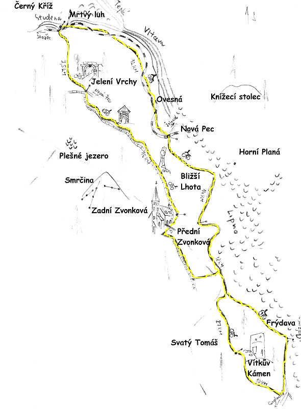
Cycling track n.1 |
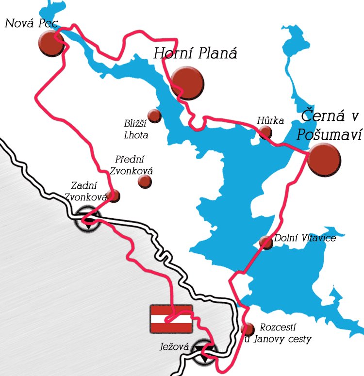
Set out from Výtoň and go along the lake to Frýdava, continue to Přední Zvonková. From there, go to Bližší Lhota, then go straight on over Smrčnický pond to Nová Pec. Follow the road along the Vltava river (against the stream) to Ovesná, to Černý Kříž and from there follow the blue tourist sign along the pond Hučina till you reach Jelení Vrchy. Follow the road along the Schwarzenberk canal to the Rosenaurova chapel, past aqueduct, pass the left turn to Nová Pec and go on over Josefův Důl to Zadní Zvonková. From there, you cross the border with Austria and you get back to the canal. Go on along Kanalstrasse till you reach the border crossing Iglbach-Ježová and follow the red sign along Soví and Růžový Vrch to the village Svatý Tomáš. Go up to see the Vítkův Kámen and then return to Přední Výtoň. |
|
|
Cycling track n.2 |
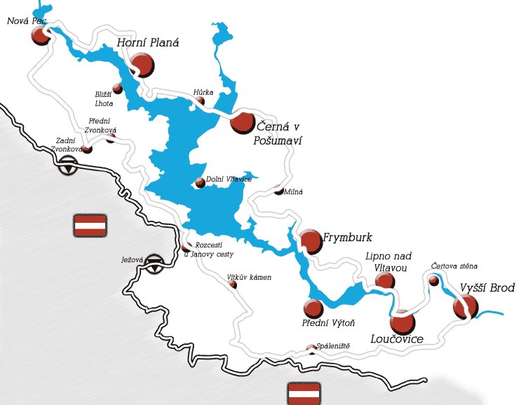
Von Lipno nad Vltavou folgen Sie gelbe Markierung auf Alpská vyhlídka (Alpenaussicht), bergab nach Plískov und dann grüne Markierung vorüber Lískovce nach Frymburg. Von Frymburg benützen Sie eine Fähre zu dem gegenüberliegenden Seeufer nach Frýdava, und dann nach links nach Přední Výtoň wählen Sie Radwege in Richtung Vítkův Kámen oder Zvonková. Von Přední Výtoň fahren Sie entlang des Lipno-Stausees bis zu der Staumauer, weiter auf der Landstrasse Richtung Vyšší Brod, links fahren Sie an Loučovice und hinter dem Dorf an Čertova stěna (Teufelswand) vorbei. Sie kommen bis nach Vyšší Brod an, und hier begeben Sie sich nach der grünen Markierung auf dem gegenüberliegendem Ufer der Moldau entlang den Kompensationsspeicher Lipno II nach Loučovice und zurück nach Lipno nad Vltavou. |
|
|
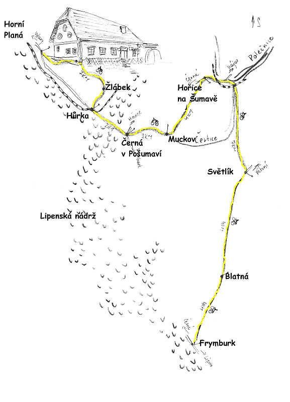
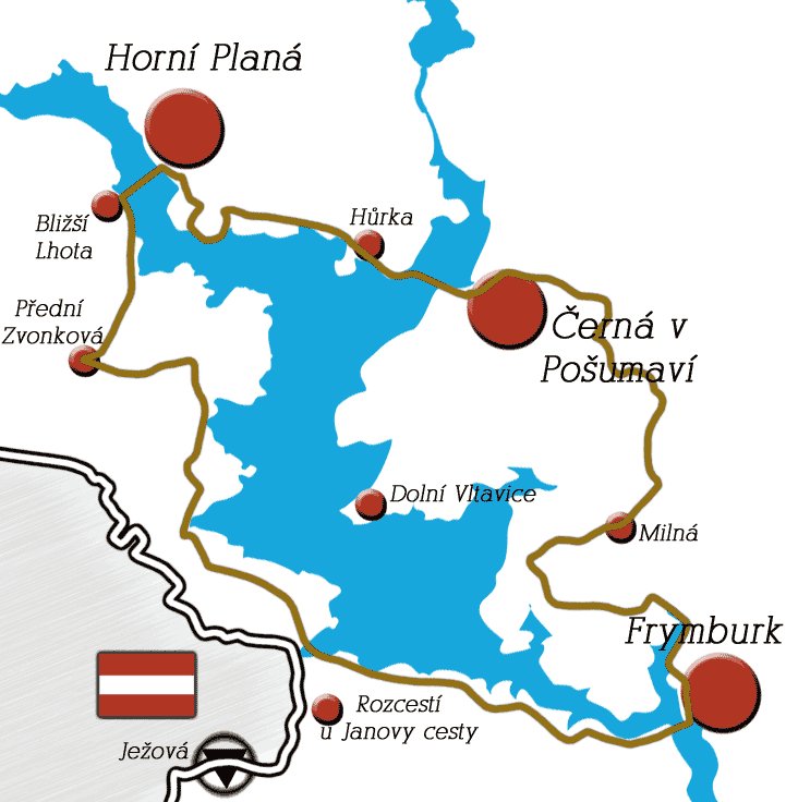
Cycling track n.3 |
Follow the yellow sign from Lipno to the view point of the Alpes, then go downhill to Plískov and there follow the green sign along Lískovce to Frymburk (see map n.2 for this part of the way). Take the road around Svatoniny Lhoty over Blatná to Světlík. Follow the green sign along the former church of Virgin Mary in Trojan, go through the valley Čertice along the former Gailův mlýn (Gail´s mill), further along the former Bhömov to Erbanov and from there to the left along the road to Hořice in the Bohemian Forest. In Hořice, follow the yellow sign to Mýtina, to Muckov and there turn right and follow the blue sign to Černá in Pošumaví. In Černá, cross the dam of the Lake Lipno to the Hůrky Lake, turn right on the railway track and follow the blue sign over Žlábek, Jelm and the Stifter´s view point to Horní Planá. You can take the same way back from there, or you can take a ferry to Zvonková and through Frýdava and Přední Výtoň over the dam you can return back to Lipno ( not stated in the map).
|
|
|
Cycling track n.4 |
See track n.3 for the way to Světlík. In Světlík, follow the blue sign cca 2km, turn right to Pasovar and there return following the blue sign over the former Cipín to Slavkov. Then to Mezipotočí, the stream Polečnice on the main road and then turn right to Novosedlí to Kájov. From there go (if you have a permit) to Boletice, if you do not have the permit, we recommend to return the same way. If you go to Boletice, go on to Polná in the Bohemian Forest and there turn right over Květušín and again right to Olšina. Go to Horní Planá. You can return along the track n.2. |
|
|
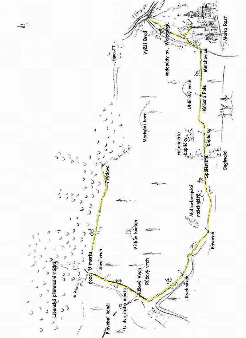
Cycling track n.5 |
Follow the track 2 to Vyšší Brod. From Vyšší Brod, go along the Opatský canal and further along the stream Menší Vltavice to the Wolfgang´s waterfalls. Then you cross the road to see the pilgrimage Maria Rast am Stein and over Mnichovice and Krásná Pole to Kapličky. Then follow the road connecting Výtoň and Guglwald, go to Pasečná and straight on to Rychnůvky. Finally, go through Růžový and Soví vrch to the Lipno dam and there turn right to Frýdava. You get back to Lipno over Přední Výtoň and the dam. |
|
|
The arterial in Lipno |
The track is a part of the arterial of the Bohemian Forest (234km) passing through the whole Bohemian Forest. The track is newly built and it is 58,5km long. |
|
|
The Schwarzenberk way |
The cycling track goes along the water canal, which used to be used for burning of wood and it is 61km long. |
|
|
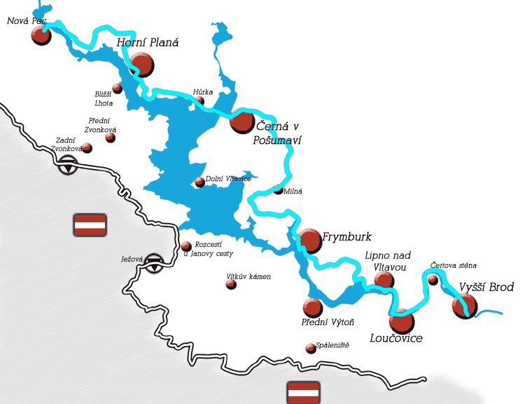
The cycling track around Lipno |
A relatively difficult track lead along the whole Lipno dam and it measures 108,2 km.
|
|
|
Following Adalbert Stifter |
The cycling track leads from the birthplace of Adalbert Stiftera through the beautiful scenery along the ruins of the castle Vítkov. It measures 65,9km. |
|
|
The lake cycling track |
The track leads around the Lipno Lake and it measures 50,5 km. |
|
|
|
|
| |